Longitude is the way the Earth is divided up east to west like segments of an orange.It is measured in degrees from 0º to 360º. The idea of longitude dates back to the 3rd century BC. So we have had around 2300 years to learn about longitude.
300 years ago, in the 18th century there was a big problem.
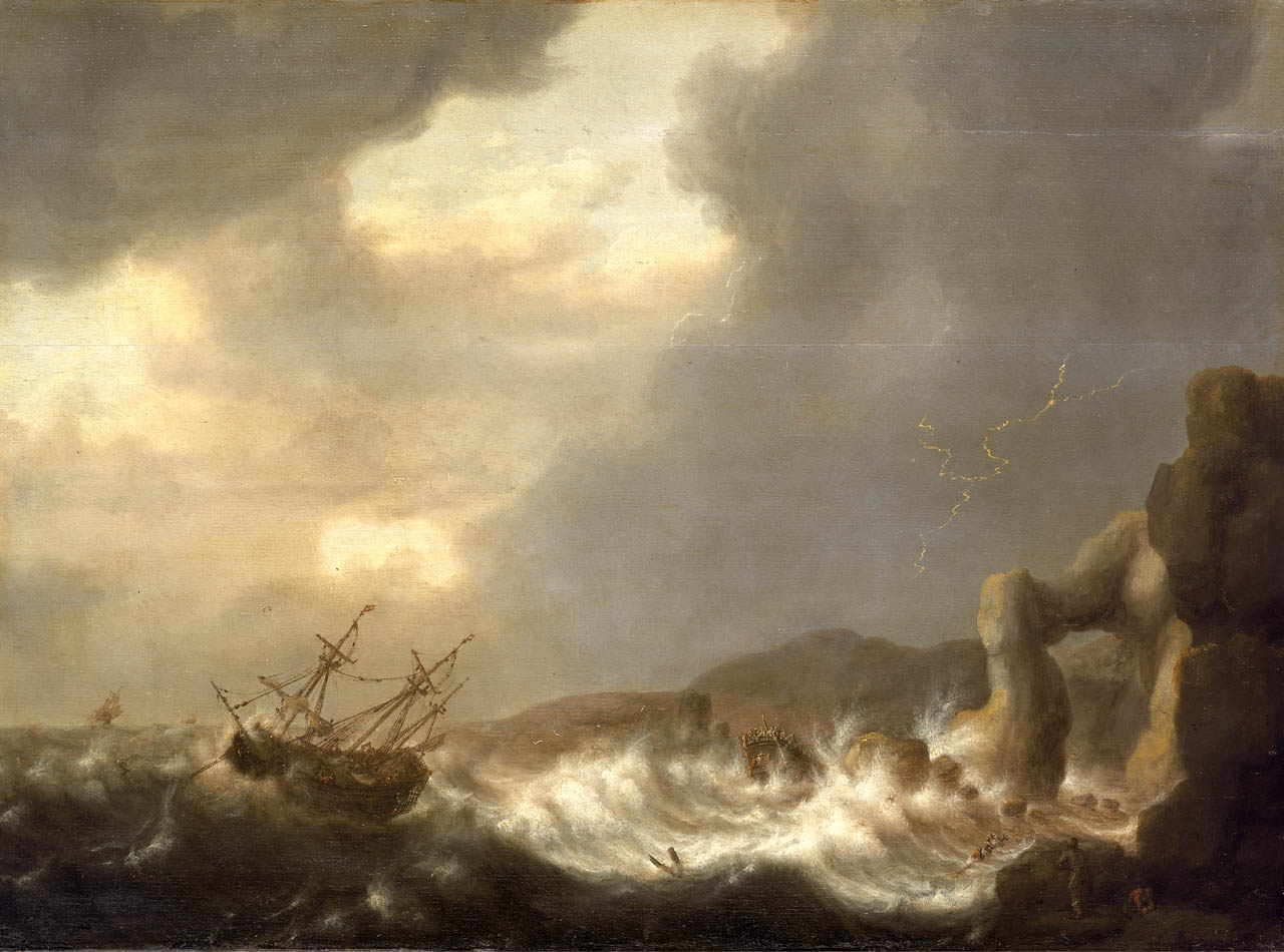
National Maritime Museum, Greenwich, London
At sea, as soon as you sail out of sight of land you cannot fix your East-West position unless you know your longitude. Not knowing how far east or west you are can lead to a shipwreck, by hitting rocks you were not expecting.
If the Earth did not spin on its axis, then you could fix your longitude by the stars. The problem is that the Earth rotates once every 24 hours so the night sky never stays still. The photo on the right shows a long time exposure photo of the night sky.
In 1714 the British Government set up the Board of Longitude and offered a huge cash prize for a solution to the problem of knowing your longitude at sea because losses of ships and sailors were so huge. To find out how many ships were wrecked each year you can look at this Wikipedia page
http://en.wikipedia.org/wiki/Category:Lists_of_shipwrecks_by_year (Opens in a new window) The other reason for such a large prize is that without knowing your longitude it is impossible to draw accurate maps or charts. The country that had the best charts had an advantage in trade and war.
Understanding the problem
These questions will guide you to understanding the problem.
Questions
1. There are 360º of longitude and the Earth rotates once every 24 hours. How many degrees does it rotate in one hour?
2. How many degrees does the Earth rotate in one minute?
3 If you sailed to the mid Atlantic as far as the 45º meridian how many hours behind Greenwich time would you be?
4. My smartphone knows where it is. What latitude and longitude is it at? What is your latitude and longitude?
In 1714, ships were sailing all round the world without knowing their exact longitude. They had compasses and could measure latitude with instruments such as the sextant.
With just a compass, a sailor can use "dead reckoning" to follow a compass bearing for a certain time making an estimate of the ship's speed. Over short distances it works well. Over long distances out of sight of land it is less accurate. Navigation errors led to many shipping disasters.
Activity - Dead reckoning
Find a large safe area like a playing field.
Use a smartphone compass or a needle compass to fix a bearing on a pole at least 200 metres away, preferably further.
Now pull a baseball cap low down over your eyes so that you can only see your feet and the compass. Follow the bearing without looking up.
How much error did you make? How much error would you make if you had to walk, say, five hundred miles?
Now imagine how much error you might make in a ship with tides, ocean currents and winds all pushing your ship off course.
CLICK FOR ANSWERS
<previous page next page>
<back to start